
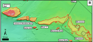
Close-up map showing the geomorphology of the Ashmore platform structure and the location of the NW and SW coring transects
(black squares)
Close-up map showing the geomorphology of the Ashmore platform structure and the location of the NW and SW coring transects
(black squares)
